New Delhi, March 25
In the tense waters of the Strait of Hormuz, where global energy flows have come under disruption, a quiet but determined effort is underway by the Indian Navy to keep the country's energy supply undisrupted.
As Iran's restrictions ripple across international energy markets amid the West Asia conflict, India, through diplomacy, has secured permission from Tehran to pass its ships through the Strait of Hormuz and has managed to sustain the movement of its shipments.
The Indian Navy has been given the responsibility of ensuring the safe return of the oil tankers. But this is not a conventional escort mission. Naval personnel are not merely accompanying tankers; they are guiding them, step by step, through one of the world's most sensitive maritime passages.
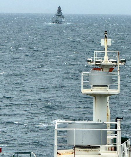
The Indian Navy has launched 'Operation Urja Suraksha'. This operation entails the positioning of over five advanced warships in the vital maritime chokepoint of the Strait of Hormuz.
According to government officials, the Navy remains in constant contact with vessels preparing to exit the Persian Gulf. Each ship is guided individually through the Strait, with precise instructions on routes and procedures designed to ensure safe passage.
The approach is cautious and deliberate, reflecting the risks that lie beneath the surface.
Once the vessels clear the Strait, Indian Navy destroyers and frigates take over, escorting them through the initial stretch of their onward journey. It is a layered security arrangement, combining guidance with protection.
This effort is being supported by an increased naval presence in the Gulf of Oman, where adequate warships and logistical resources have been deployed to ensure that escort operations continue without interruption.
For the crews aboard these tankers, the journey is far from routine. Modern shipping relies heavily on navigation systems built on hydrographic charts -- detailed maps of the ocean floor that make safe passage possible. Without them, movement through such waters would be fraught with danger.
The risks are not theoretical. According to media reports, US Intelligence agencies have alleged that Iran has deployed underwater mines in and around the Strait of Hormuz. These mines, capable of causing severe damage, add to the uncertainty that vessels must navigate. Other potential threats in the region further heighten the sense of caution.
It is in this environment that the Indian Navy's guidance becomes critical. By directing Indian-flagged vessels along carefully identified safe routes, it helps crews avoid unseen hazards and move forward with a measure of confidence.
Much of this capability rests on hydrographic charts, which remain indispensable. Beneath the sea's surface lies a constantly changing landscape. Ocean depths vary widely -- from just a few metres near harbours to several thousand metres in open waters -- and natural events such as tsunamis can alter the seabed over time.
These charts are created by specialised survey vessels that scan the ocean floor, mapping its contours and identifying safe navigation channels. Across the Arabian Sea and the Indian Ocean, a vast number of vessels -- ranging from warships to container carriers and oil tankers -- depend on charts produced by India.
The Indian Navy's hydrographic work extends beyond national waters. It also assists friendly countries, at their request, in surveying their Exclusive Economic Zones and preparing navigation charts. Agreements with several nations in the Indian Ocean Region allow India to contribute to safer maritime operations far beyond its own coastline.
Once prepared, these charts gain international acceptance and can be used by any country or commercial entity.
In a region marked by tension and uncertainty, this combination of guidance, expertise, and quiet coordination is helping ensure that ships continue to move -- carefully, steadily, and safely -- through one of the world's most critical waterways.